 |
 |
 |
|
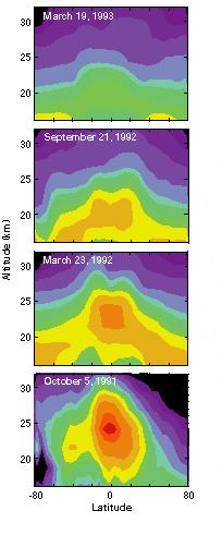
6-Month Snapshots of the Decay of the Mt. Pinatubo Aerosol Cloud
ISAMS and CLAES measured aerosol amounts following the eruptin of Mt. Pinatubo. The initial aerosol cloud (red to blue) is confined mostly to the tropics and extends to 30 km in altitude. As time passes, the aerosol cloud slowly descends and moves to middle latitudes and into the troposphere.
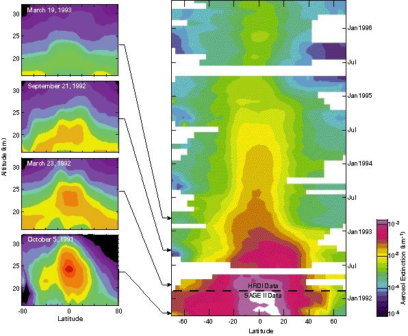
Global Time Series of Mt. Pinatubo Aerosol at 25 km
HRDI measured aerosol amounts at 25 km throughout the stratosphere following the eruption of Mt. Pinatubo. Aerosols in the tropics persist while those at middle latitudes are quickly flushed from the stratosphere. In the figures below, red and orange indicate heavy aerosol concentrations; blue and purple indicate lower aerosol concentrations.
|
|
|
|
|
Last modified: March 08, 2017