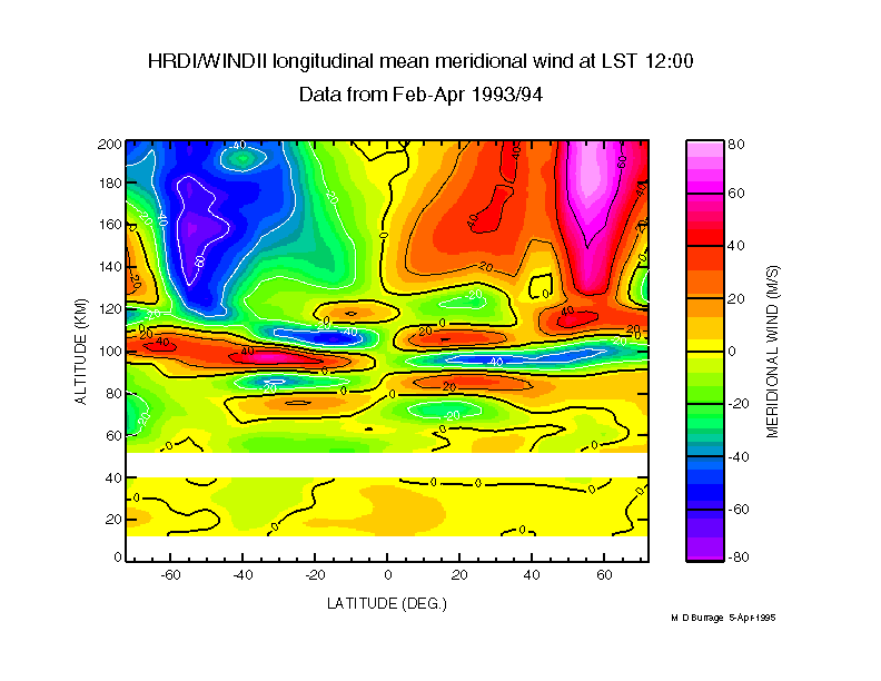
HRDI_WINDII_MWIND
Composite of HRDI and WINDII meridional winds
from the spring periods of 1993 and 1994 in the altitude range
10-200 km, for a local time of 12:00. The
prominent oscillations about the equator in the MLT region are due
to the (1,1) diurnal tide. |
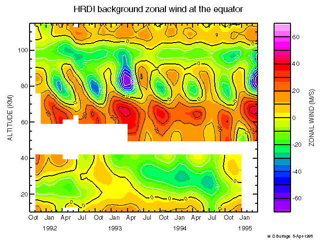
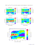
HRDI_EQ_BACKGROUND_ZWIND
Monthly mean background zonal winds (averaged
over longitude and with the tides removed) observed by HRDI at the
equator from November, 1991 to March,
1995. The mesosphere semiannual oscillation (SAO), maximizing near
an altitude of 80 km and the quasi-biennial oscillation (QBO),
peaking near 25 km, are the
most prominent features.
|
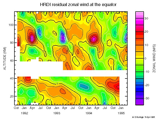
HRDI_EQ_RESIDUAL_ZWIND
HRDI equatorial background zonal winds with the
semiannual and annual variations and a linear trend term and mean
removed to reveal the 'residual' flow, which
clearly shows a biennial variation in the MLT region which is
anticorrelated in phase with the stratospheric QBO.
|
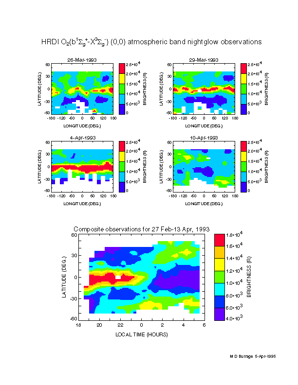
HRDI_NIGHTGLOW_MAPS
Brightness maps (upper 4 panels) of the O2
nightglow observed by HRDI on 4 different days. The prominent band
at the equator is a tidal feature which brightens
and then disappears due to the local time precession of the UARS
orbit. The diurnal tidal behavior of the nightglow is more clearly
shown in a composite of about 6
weeks of data (lower panel), which shows the local time
variability as a function of latitude.
|
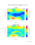
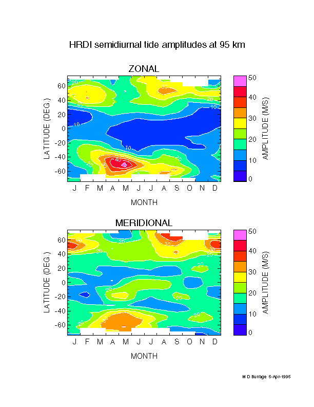
HRDI_SEMIDIURNAL
HRDI monthly mean semidiurnal tide amplitudes
for the zonal (upper panel) and meridional wind (lower panel)
components at an altitude of 95 km. Strong seasonal
variabilities and interhemispheric asymmetries are revealed.
|
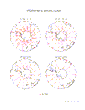
HRDI_VORTEX_BREAKUP
Sequence of 4 HRDI southern hemisphere wind
maps, documenting the breakup of the polar vortex during the
Antarctic spring of 1993.
|